NST ANIMATED MAPS
3D ANIMATED MAPS FOR THE REVELSTOKE AND VALDEZ STOPS OF THE NATURAL SELECTION TOUR.
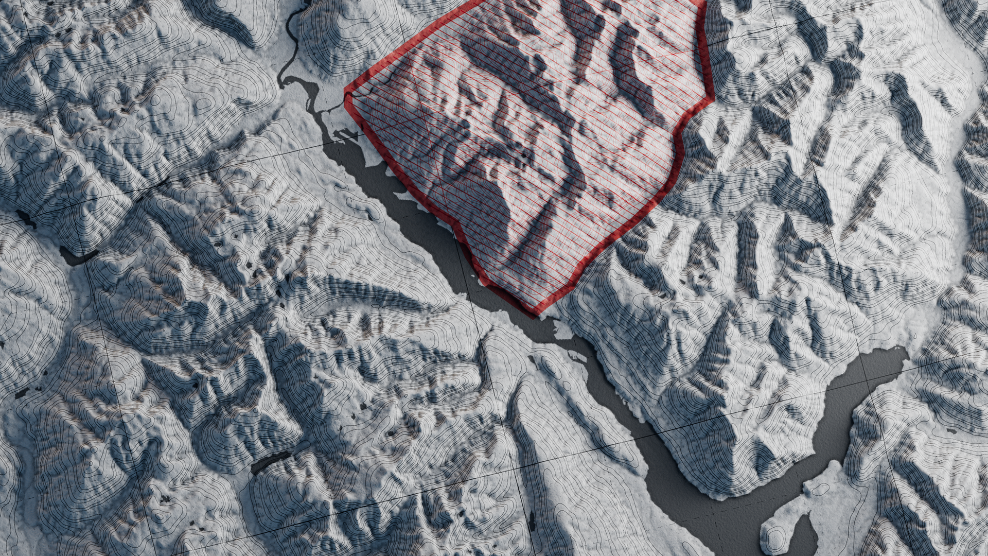
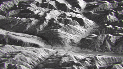
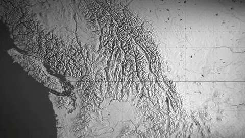
Participating in the Natural Selection Tour (NST), a globally renowned extreme sports event, was an incredibly exciting adventure for our team at Profanity Creative. We had the unique opportunity to contribute to the event by creating geologically accurate 3D maps of two challenging terrains: Revelstoke, British Columbia, and Valdez, Alaska. Our goal was to amplify the narrative of the event, providing viewers with a precise and immersive understanding of the landscapes that the athletes were navigating.
CONCEPT & STRATEGY
Turning Data Into Visual Storytelling
NST’s competition venues are more than just mountains—they’re uncharted battlegrounds where the world’s best riders navigate natural lines, deep snow, and unpredictable conditions. To effectively communicate each venue’s scale, features, and challenges, we had to build a visual framework that was both accurate and engaging.
NST’s competition venues are more than just mountains—they’re uncharted battlegrounds where the world’s best riders navigate natural lines, deep snow, and unpredictable conditions. To effectively communicate each venue’s scale, features, and challenges, we had to build a visual framework that was both accurate and engaging.
• Sourced high-resolution GIS and DEM terrain imagery, ensuring precision in elevation and landscape details.
• Analyzed competition zones to highlight key features like cliffs, chutes, and tree lines.
• Planned how the maps would be integrated into NST’s web series, ensuring they worked seamlessly with commentary and athlete insights.
This phase ensured we weren’t just making maps—we were crafting narratives that amplified the raw beauty and intensity of each competition zone.
PRODUCTION & DESIGN
From Raw Data to Immersive Visuals
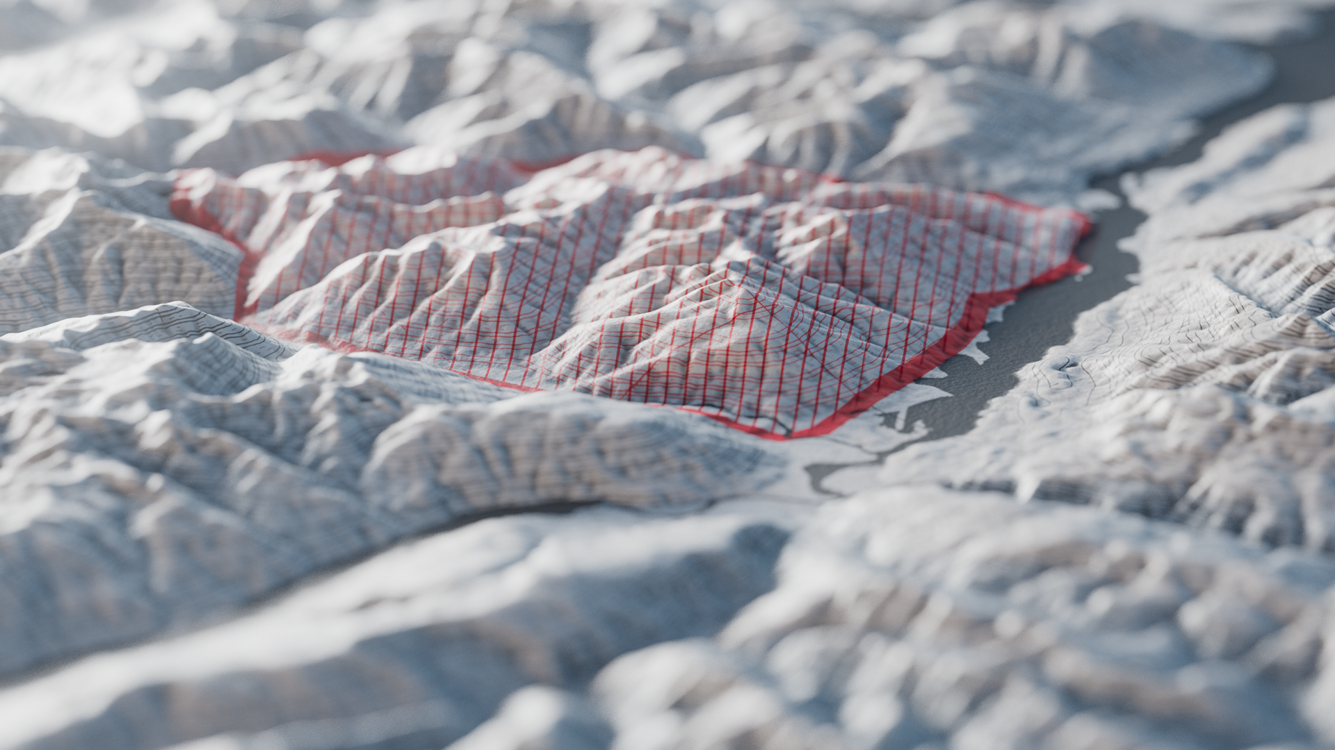
Once we had our terrain data locked in, we shifted focus to designing maps that weren’t just functional, but cinematic.
Once we had our terrain data locked in, we shifted focus to designing maps that weren’t just functional, but cinematic.
• Transformed raw GIS and DEM data into visually dynamic 3D landscapes, creating depth and realism.
• Customized textures, lighting, and shading to match NST’s branding and give the maps a distinct, high-end look.
• Designed overlays to highlight rider zones, potential lines, and hazard areas, making it easier for audiences to follow the action.
By balancing technical accuracy with artistic direction, we created maps that didn’t just explain the terrain—they made you feel like you were standing on it.
REFINEMENT & DELIVERY
Making the Maps Work Across Every Medium
The final step was seamlessly integrating the maps into NST’s web series and event coverage. These maps weren’t just static graphics—they were designed to be dynamic, interactive, and adaptable across platforms.
The final step was seamlessly integrating the maps into NST’s web series and event coverage. These maps weren’t just static graphics—they were designed to be dynamic, interactive, and adaptable across platforms.
• Optimized maps for video production, ensuring smooth integration with motion graphics and commentary.
• Provided high-resolution stills for social media, broadcast, and digital content, making them a key asset in the overall marketing strategy.
• Refined details based on athlete and producer feedback, ensuring accuracy and clarity.
The final result? A groundbreaking way to showcase competition venues, giving NST’s audience a richer, more immersive viewing experience while solidifying the tour’s reputation as a leader in progressive snowboarding.